Leica RTC360: A new approach to Terrestrial Laser Scanning
Posted by John Alexander on 22nd Aug 2019
https://www.youtube.com/watch?v=jJjAf79nmw0
Leica RTC360: A new approach to the
Terrestrial Laser Scanning workflow
1. Summary
This paper presents and summarises the innovations introduced to the Terrestrial Laser Scanning workflow by the RTC360
3D Reality Capture solution.
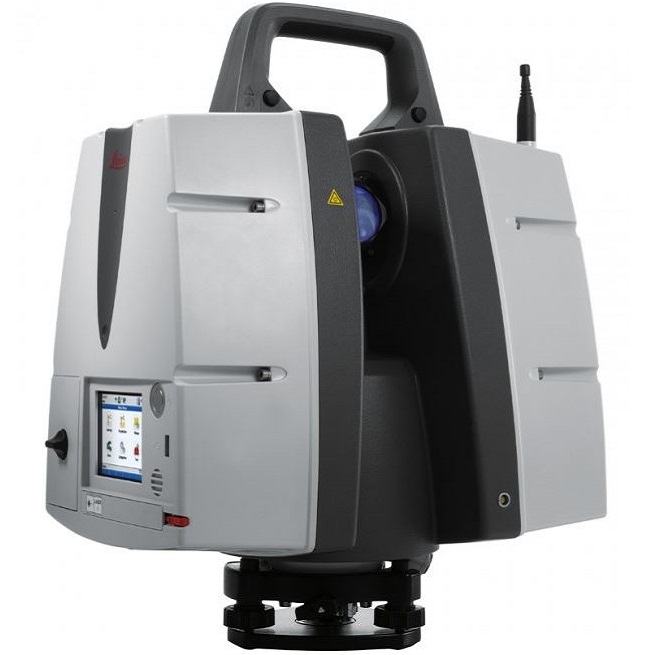
With the RTC360 solution, Leica Geosystems creates a powerful and efficient workflow for Terrestrial Laser Scanning. It
has been designed as an overall system: from data acquisition in the field, to the final deliverable in the office. The system
is built around three main elements: the RTC360 3D laser scanner, Cyclone FIELD 360 mobile-device app and Cyclone
REGISTER 360.
The RTC360 solution (RTC stands for RealiTy Capture) has the primarily goal to be suited to non-surveying professionals,
due to the high level of automation and data enhancement on the field. As 3D scanners over the last years have become
much faster, more accurate and more efficient, one of the main obstacles for the wider adoption of the terrestrial
laser scanner as reality capture technology, is the complexity of the registration of the scan data coming from different
positions.
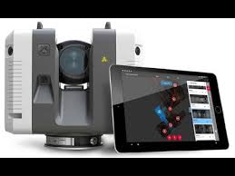
The RTC360 solution addresses this problem by automating the registration process and making results directly verifiable
in the field. The key embodied technology is the “Simultaneous Location and Mapping” (SLAM) method, integrated into
the Visual Inertial System (VIS) of the RTC360 laser scanner. By continuously tracking the pose of the RTC360 while
moving, VIS allows to align the point-clouds in real-time on the field.
Cyclone FIELD 360 mobile-device tablet app provides field functions such as data check, review and data enhancement.
Cyclone REGISTER 360 completes the workflow with fully automated data registration and deliverables creation.